"If love could shine through ink, these pages would glow."
- Ruth Kirk, Sunrise to Paradise
Be sure to check out our Photo Gallery!
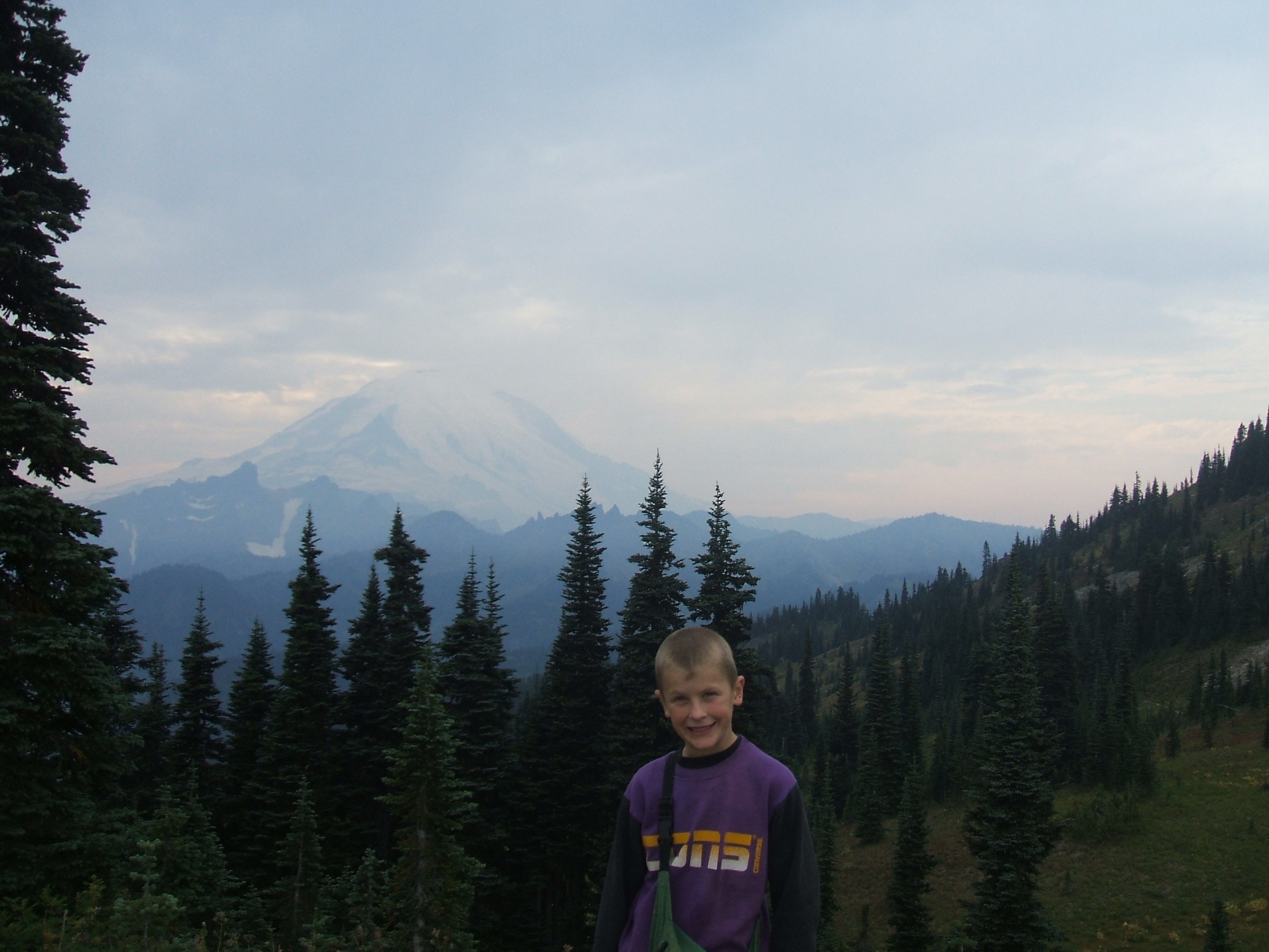
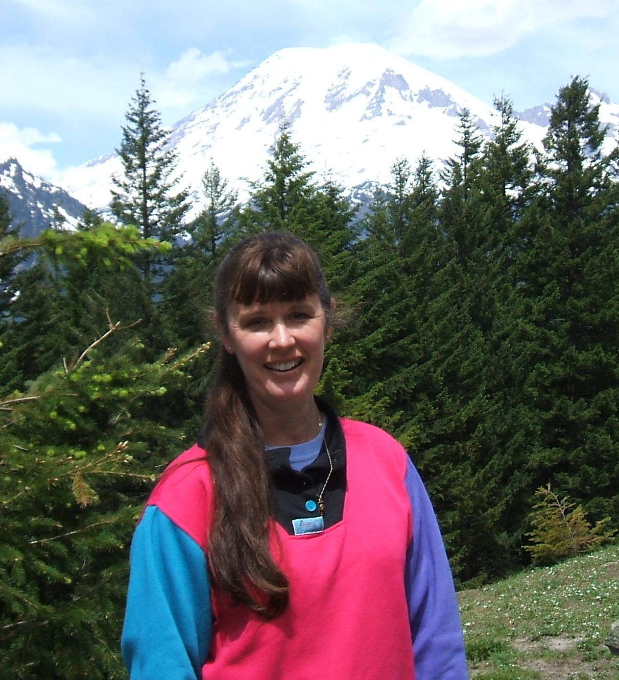 "The Mountain is out." No words so as sweet to a true-blue Rainieraholic like me. My personal history with the Mountain - as we Washingtonians call our mightiest monarch and the most venerated icon of the Northwest - dates back to 1963. And yes, we've hiked alot at "our" Mountain. So when "The Mountain is out," it's going to be a good day. Especially on the trails.
This page is devoted to the top hits on our "Rainier Day Hike Parade." The hikes listed here earn our top two ratings: the Hand-Cranked, Homemade (HCH) and Haggen Dazs (HD). As in, it just doesn't get any better than this. If you visit Mount Rainier National Park and only have time for one or two hikes, choose one of these, especially on a fine, clear day in late summer or early Fall. (Please refer to my rating system for specifics. Always STAY ON THE TRAIL and carry the Ten Essentials. Remember, these hikes are at altitude, so bring sunscreen, plenty of water and plan accordingly.) These are summaries. Keep reading for Tales from the Trail (below), and don't forget to visit the Photo Gallery.
Earning the HCH rating: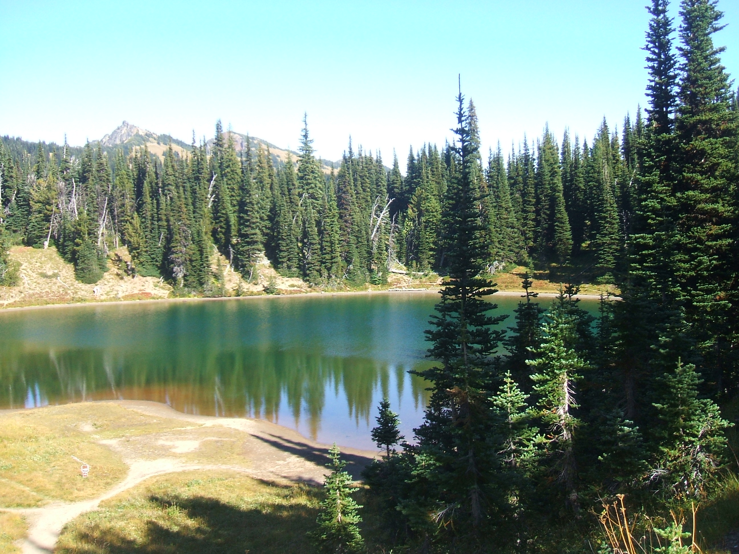
Burroughs Mountain/Frozen Lake hike out of Sunrise. Start at the upper end of the picnic area, take the Sourdough Ridge Trail (left) to Frozen Lake. Then climb up the Burroughs Mountain Trail to spectacular arctic-tundra type scenery and jaw-dropping views of the Mountain and the Emmons Glacier. Return via the Sunrise Rim Trail, past Sunrise Camp and green-blue Shadow Lake.
High Lakes Loop to Paradise - Some of the most beautiful wildflowers, alpine meadows and eye-popping panoramas on the planet. If you start your hike at reflection Lakes and hike counter-clockwise - which we recommend - don't forget to look over your shoulder from time to time, especially from Mazama Ridge. On a clear day you'll see the jagged Tatoosh Range and a good chunk of Oregon.
Naches Peak Loop - Begins at Tipsoo Lake. Picnic at the lake at one of several tables just off the parking lot, then strike out on this easy loop, one of the most popular hikes in the park. Start at the pacific Crest Trail at Chinook Pass. Continue on the east side of Naches Peak 1.6 miles until intersecting with the Naches Loop Trail. Follow the loop tail along the west side of the peak another 1.4 miles back to Tipsoo Lake. For the best views of the Mountain, hike in a clockwise direction. This trail offers breathtaking views of Mount Rainier, luscious subalpine meadows, and lots of huckleberries in late summer and early fall.
Earning the Haggen Dazs (HD) Rating:
Dege Peak - A moderate trail out of Sunrise. Follow the nature trail to the right, then head east on the Sourdough Ridge Trail to the Dege Peak spur trail. It's a steady uphill climb to the peak, mostly above the treeline. Wear sunscreen, a hat, and bring plenty of water. Outrageous views of the Olympic Mountain Range reward the hiker at the summit. On a fine, clear day the sky is impossibly blue here, the air as fresh and pure as it gets. 4.2 miles.
Snow & Bench Lakes - 2.5 miles, RT. Trail begins off Stevens Canyon Road, about 1.5 miles east of Reflection Lakes. Bench Lake gets its name from the flat area around the lake called "the bench." (Clever, huh? :) Snow lake may been named thus because the cirque in which it lies fills with icy meltwater from the snowfields of the Tatoosh Range, or because snow often rings the lake until late summer. In mid-summer, this area burts with a variety of blooms. In the fall, mountain ash and huckleberries color the scene as well as a silver forest of trees, stark survivors of a previous fire. Good views of the Mountain in clear weather. This is also "one of the best places in the park to see hummingbirds," so keep your eyes peeled!
Nisqually Vista - Starts near Paradise Visitor Center. At 1.2 miles RT, this is an easy hike and a good one for families with little ones. Offers jaw-dropping views of the Mountain and the Nisqually Glacier.
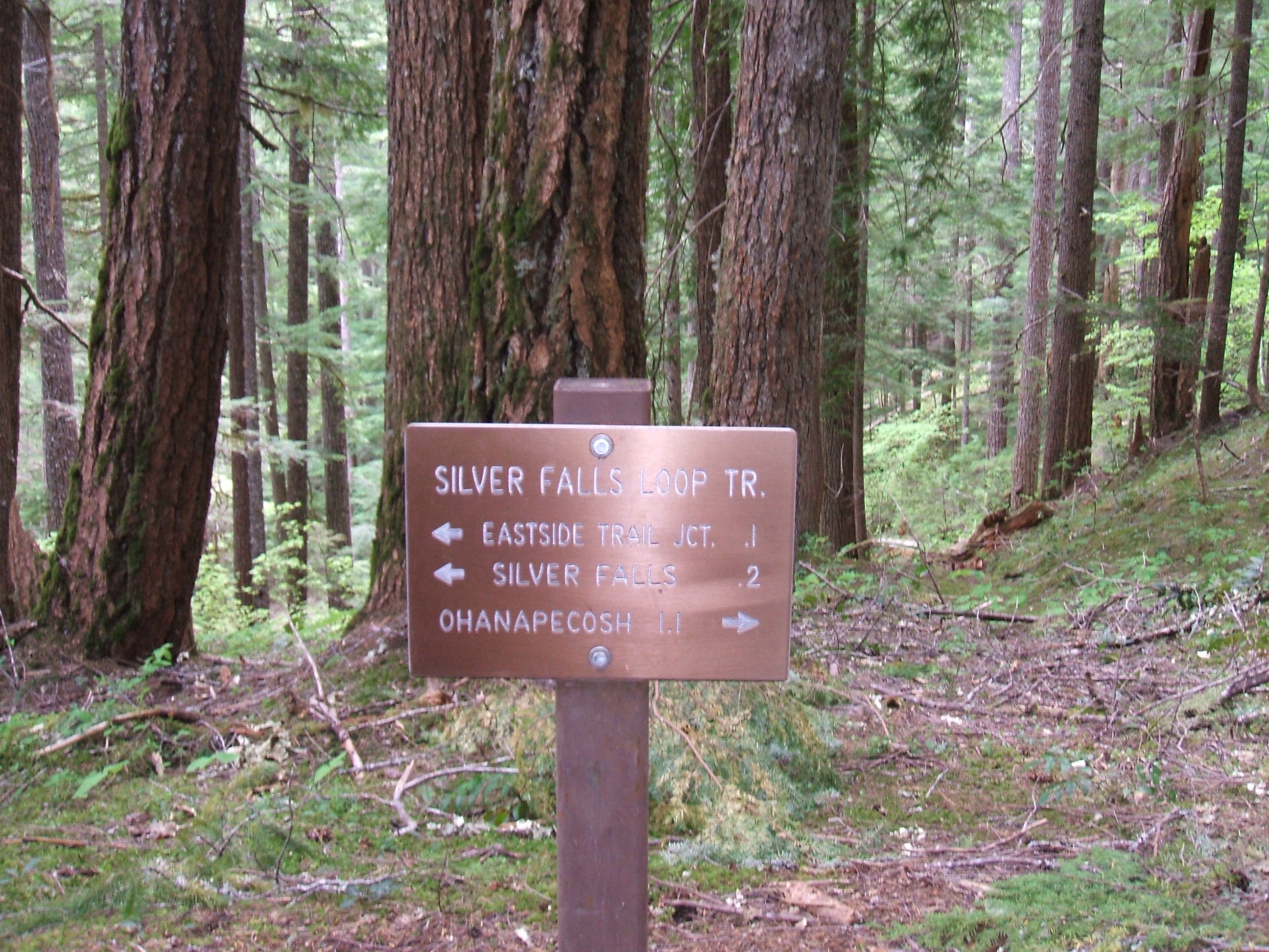 Silver Falls Loop - One of the most well-worn hikes in the park. It's up and down, but not particularly steep, and less than 3 miles RT. The highlight is Silver Falls, which is a silver cascade of water racing over boulders and downed trees in early June. Options include going further on the Eastside Trail and crossing Stevens Canyon Road to link up with the Grove of the Patriarchs Trail.
Also see our Trail Tips and FYIs
Tales from the Trail: September 2009
Naches Peak, Frozen Lake/Burroughs Mountain, High Lakes
Tipsoo Lake and the Nach es Peak trailhead. Postcard-perfect weather. Sunny. Clear as a bell. No snow in sight as we strike out
on one of the most popular hikes in the park just behind the lake, near Chinook Pass. We hike clockwise, and the Mountain offers stunning scenes. Stopping at an un-named blue-green tarn about a mile into the trail, we christen it "Josiah's Pool." It's small but as clear as glass.
Returning to Ohanapecosh campground for dinner, we roast hot dogs and sing Christmas carols around the camp fire. Our "neighbors" think we're kind of kooky - what else is new? We invite them to join us for s'mores and a "Christmas in September" carol sing from the hymnal.
Night snaps shut as if on hinges. One minute it's twilight, the next it's as dark as the La Brea tar pits at midnight. In the gathering dusk - that nefarious in-between time when it's neither fully day nor true night - high clouds crepe paper the darkening sky above Ohanapecosh, spilling shades of peppermint, pomegranate and peach over Backbone Ridge and the Ohanapecosh River. Moments later the winds shift and the streamers broaden into think sheets of shimmering rose and alabaster, like pink frosting spread by a celestial hand.
We stroll to the Ohanapecosh River at sunset. We're astonished at how low the river seems. it must've dropped six or feet since we were last here in June. It's been a fairly "dry" summer - by western Washington standards - but rivers and streams inside the park seems thin and thirsty.
Back at the campsite, we take turns reading aloud from C.S. Lewis - a somewhat dodgy business by flashlight or lantern - but a memorable evening around the campfire. Later, we open John Eldredge's Walking With God and read:
"Are you beginning to see now how essential joy is?
Because we live in a world at war. Because the enemy is relentless. Because we are 'hard pressed on every side' (2 Corinthians 4:8). For these very reasons we need joy. Lots and ots of joy. Bucketfuls. Wagonloads. Joy can counter the effect of all this unrelenting other stuff. Without it we'll get drained from the battle, sucked dry. We won't have anything to draw upon. No inner reserves. We'll waste away. Throw in the towel. Or we'll fall into an addiction because we are absolutely starved for joy. ...
If you walk with God, you will find yourself called up to the real thing. Intense battle. Authentic joy. The battle wil find you. But you have to be intentional about joy." (Walking With God, p. 114.)
How kind of God to remind us.
The sunrise sky blooms rose, hyacinth and daffodil. We want to burst into song like Curly riding through an Oklahoma cornfield bellowing, "O, what a beautiful morning!" Because it is. Morning creeps down Backbone Ridge and pours in Ohanapecosh like water off a sieve, gilding green columns of hemlock, alder and Douglas fir. Blue camp fire smoke wafts into the crisp morning air, and on it comes the aroma of sizzling bacon, blueberry muffins, steaming tea and rich hot chocolate. After breakfast we load up the backpack, water bottles, sunscreen, snacks and supplies and drive an hour up the 123 to the Mather Memorial Parkway, thru the park's White River entrance ($15 entrance fee) and on up the serpentine coils of the road to Sunrise, the highest paved road in the state.
 A few word to the wise when tackling trails out of Sunrise:
- At 6,400', Sunrise is the highest point in the park accessible by vehicle. Many of the trails are five miles or less RT. However, be advised that nearly all trails here are at least partially uphill. Most are above the treeline. Be prepared to climb.
- Sun and wind can be intense. Dress in layers. Wear a hat. Bring sunscreen and plenty of water.
- You're hiking at 6,400 feet-plus. The air is thin, so don't over-exert. Allow plenty of time and remember: TISJ (Take It Slow, Joe).

We chose the Frozen Lake/Burroughs Mountain Trail. We hiked to Frozen Lake last September ('08) with Sam and Josiah. it was 36 degrees, pouring rain, whipping wind and then sleet. What a difference a year makes! We start with a steep ascent at the upper end of the picnic area, then follow the Sourdough Ridge Trail to the junction at Frozen Lake. This is the "hub" of Rainier hikerdom on the Mountain's east flank. Like a freeway interchange in downtown Los Angeles, no less than a dozen (we counted!) different trails branch off from here. Options galore. Choose carefully.
The Frozen Lake/Burroughs Mountain Trail isn't hamstring-hollerin' steep, but it's a steady, sustained uphill tread for over three miles. The trail is almost entirely out in the open, above the treeline, so shade is rare. The "moonscape" landscape is similar to the terrain found in the Arctic tundra. The afternoon temperature out on the trail is 80 degrees. At the summit of Burroughs Mountain - 7,000 feet up - a jaw-dropping panorama unfolds. The day is fine and clear and you can see Honolulu from here! Almost. Forty mph wind gusts snap at our nose and ears. Not much grows here above the treeline, the result of fierce winds and elevation. Today the pleasant combination of warm temperatures and snappish breezes keeps us form getting either too warm or too cold. The weather is postcard-perfect and the Mountain is out all day as we round Burroughs Mountain - it seems like the top of the world - and return to Sunrise via the Sunrise Rim Trail and Sunrise Camp, a high-altitude wilderness camp. It doesn't get any better than this. See our Photo Gallery for more.
After a breakfast of bacon, biscuits and gravy and blueberry muffins the next morning, we head to Packwood for more ice for the cooler - it's been unusually warm - and more firewood. Then into the park via Stevens Canyon Road, through Box Canyon (see Photo Gallery), where the "chocolote milk" river gushing over rocks and boulders off the Cowlitz Glacier crashes down the Mountain, scraping debris with it, 180 feet from the canyon to the surface of the water. Winding steeply up Stevens Canyon Road toward Reflection Lakes and Longmire, we pass Louise Lake, Sunbeam Creek on the right and continue climbing to Reflection Lakes at about 4,800 feet up. It's about 30 miles to Longmire from the Stevens Canyon Park Entrance, but the windy drive takes about an hour. More than 50 waterfalls ranging from trickles to gushers cobweb Stevens Canyon. Vine maples light up the flanks of Stevens Canyon Road like neon signs. The air is crisp and fallish.
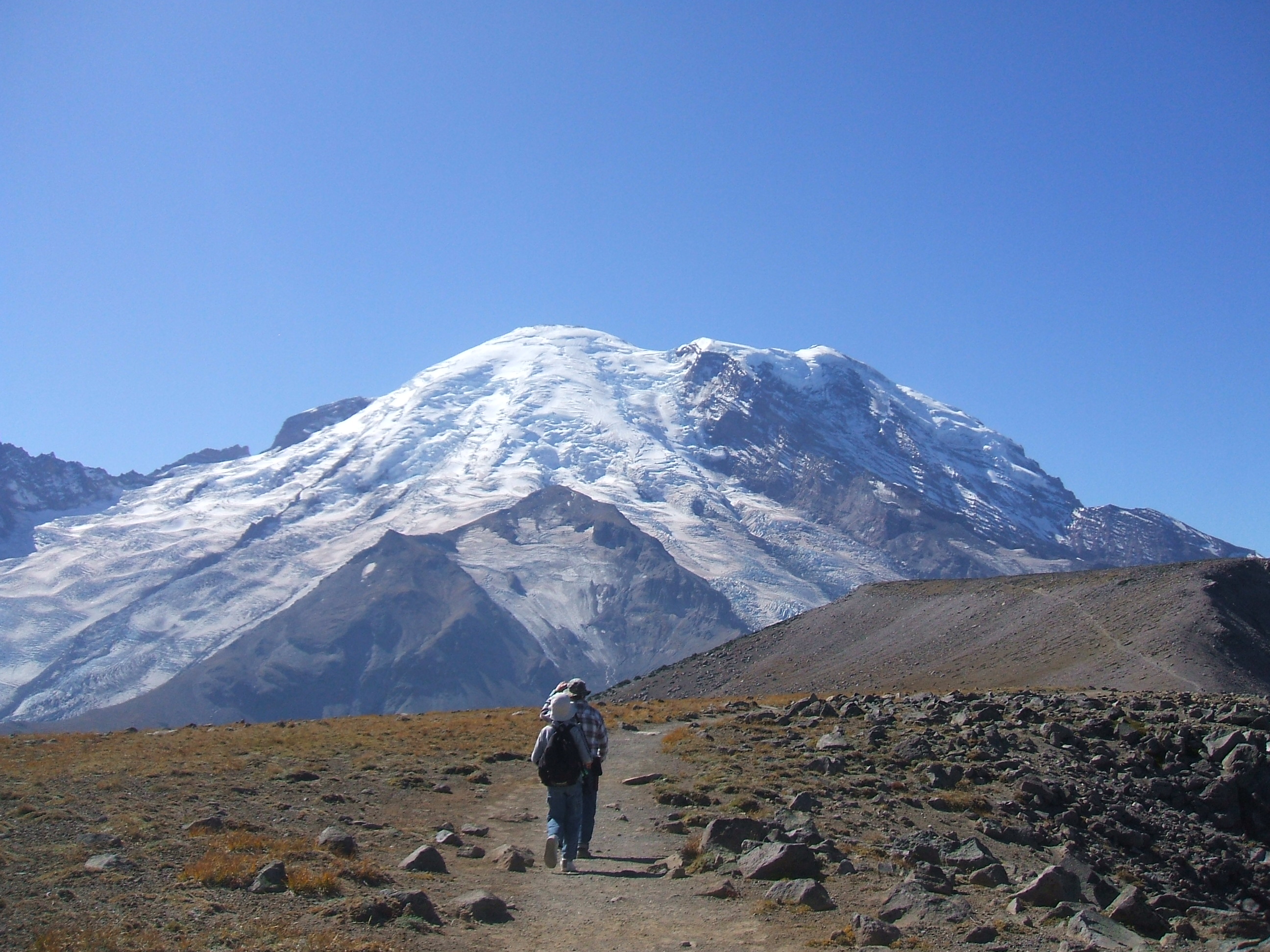
Reflection Lakes (Yes, it's plural - there are two lakes, one large, one smaller) is popularly known as "the most photographed spot in the park." On a fine, clear day when the Mountain is out, you can see why. (See Photo Gallery) If you've only seen one photo of the 'ole Beauty on a postcard, calendar, placement, or book, etc. - chances are good that the photo was taken at Reflection Lakes. We arrive at the lakes around noon. Brisk winds have whipped up around the Mountain's crest, swirling snow and giving her a hazy crown. It's not the best weather for "postcard-perfect" pictures, but we'll be back.
High Lakes Loop Trail to Paradise. While we're on the subject of Reflection Lakes and "tales from the trail," it's a cryin' shame that so many weekend tourists cruise through Mount Rainier National park and never leave their vehicles - or the pavement - and they think they've "seen" the 'old Beauty. Not! There's only way to get to know the Old Girl - you have to get out of your car and take a hike. Today's trail choice is a beaut in every sense of the word: the High Lakes to Paradise Loop Trail, which includes lofty - and aptly named - Faraway Rock, an infinite number of lovely, mirror-like alpine tarns, wildflowers galore, and some of the most breathtaking vistas on the world from atop legendary Mazama Ridge. As we hike along the ridge under an intense sun and clear skies, we notice movement about 25m off the trail. Sure 'nuf, there's a humongous black bear munching blueberries in a patch of shade under some Douglas fir trees. We snap a quick picture and leave him to his lunch. A couples miles later, it's 78 degrees at Paradise as we stroll into the new Henry M. Jackson Visitor Center, rest and snack a bit, snap some pix and then launch into the return leg of the loop trail. It took us about three hours to climb to Paradise from Reflection Lakes. Forty-five minutes of a stiff downward descent - except for that one STEEP section just off the Stevens Canyon Road crossing - and we're back to the Lakes and the car. We'll be back to Ohanapecosh in time for dinner.
In Lummi Indian legend, Mount Rainier deserted
her husband, Mount Baker, and took all the choicest fruits and flowers
with her. On summer afternoons when the Chinook winds flutter alpine
frocks and frolic over blushing swells of mountain heather, lavendar
asters, shaggy white anemones, and the flaming heads of Indian
paintbrush, you can't help but feel the legend is true - and that Ruth Kirk is right.